
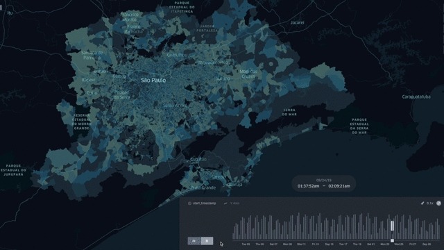
Mobility Trip Patterns for Delhi and Dallas
> This blog posts delves into the mobility data and trip hop movement patterns for the largest metropolitan regions in Texas and the largest metropolitan region in India. > Sign up for our
> This blog posts delves into the mobility data and trip hop movement patterns for the largest metropolitan regions in Texas and the largest metropolitan region in India. > Sign up for our
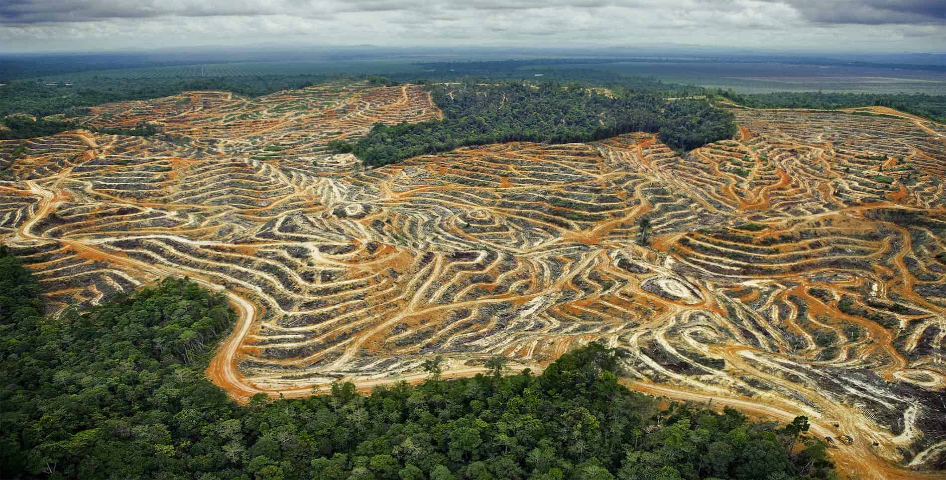
> This blog posts delves into the movement patterns between the palm oil plantations and the refinery mills in Sabah, Malaysia. > Sign up for our webinars to learn from our data scientists
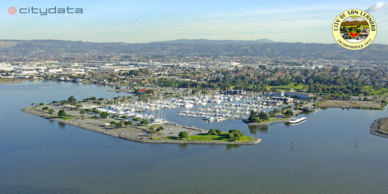
Citywide data insights dashboard spanning four departments and seven datasets for the City of San Leandro, California, USA CITYDATA.ai [http://citydata.ai/] has designed and developed a unified data analytics dashboard called
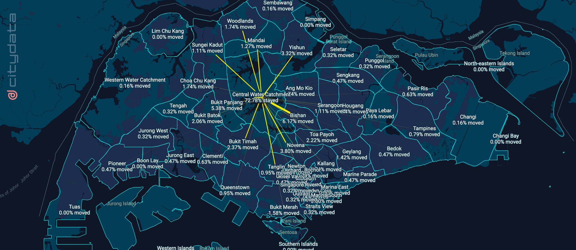
> This blog posts delves into the mobility data and trip hop movement patterns for one of the largest metropolitan regions in the United States. > Sign up for our webinars to learn

> This blog posts delves into the footfall data insights and visits trends for Scottsdale's McDowell Sonoran Preserve in Maricopa County, Arizona. > Sign up for our webinars to learn from

Join our webinars to learn from our data scientists and geospatial experts. They will show you how geospatial intelligence can be used in the most cost-effective way to measure, analyze and advocate local

The U.S. Department of Commerce and the International Trade Commission have declared that the EU-US Privacy Shield framework is no longer a valid mechanism to transfer personal data from the European Union to the United States.

This blog post discusses the role of geospatial data for advocating and measuring the essential role of parks and recreational areas in and around cities and metropolitan areas.
The Data for Humanity initiative helps government agencies & health researchers with people movement analysis and geospatial dashboards related to COVID-19.

Ferdinand Magellan's famous expedition from Spain with five ships and 270 men in an effort to find a western sea route to the rich spice islands of Indonesia.
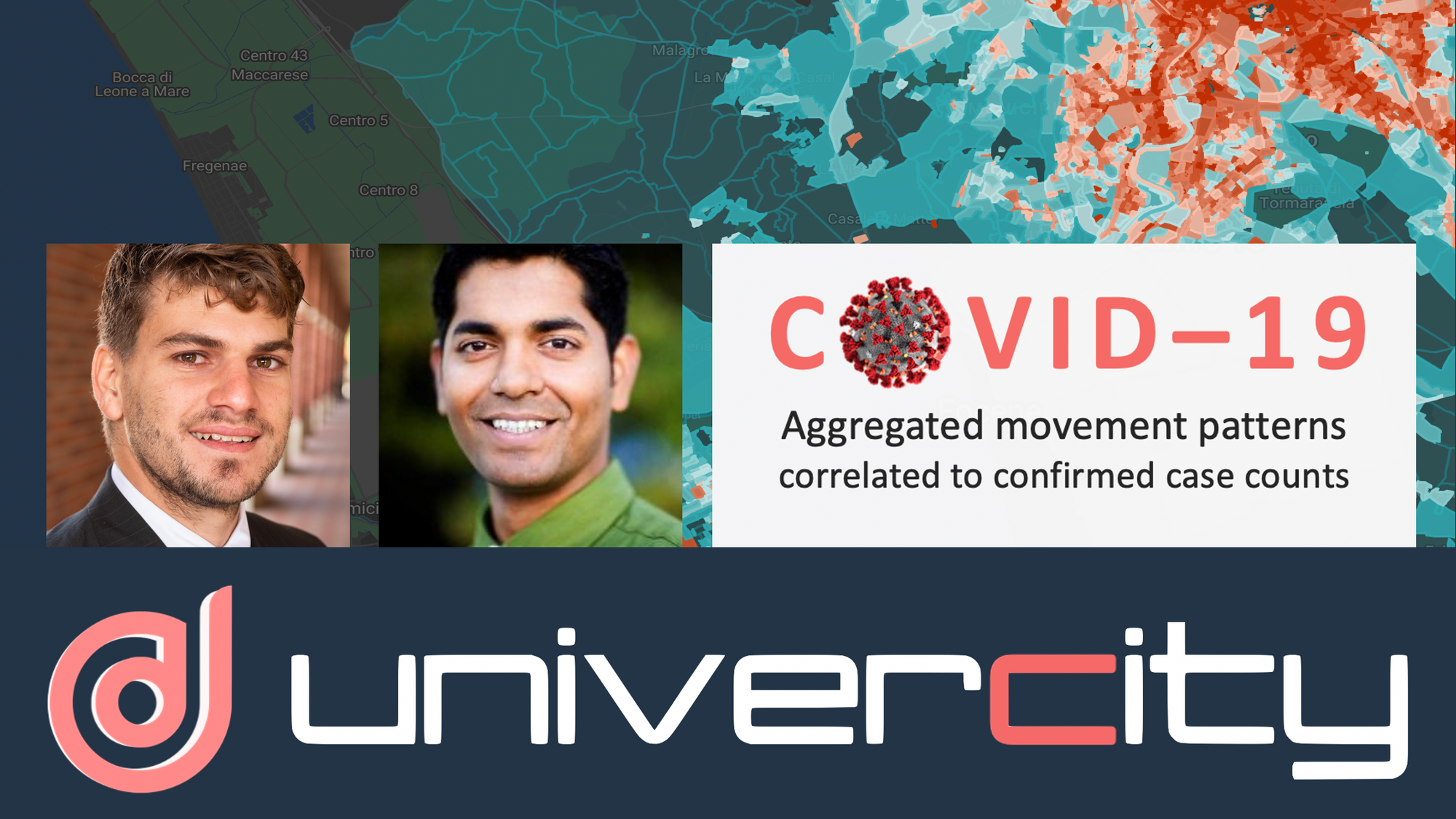
This blog posts uses live demos to explain how to measure and correlate people-movement patterns with COVID-19 propagation patterns.
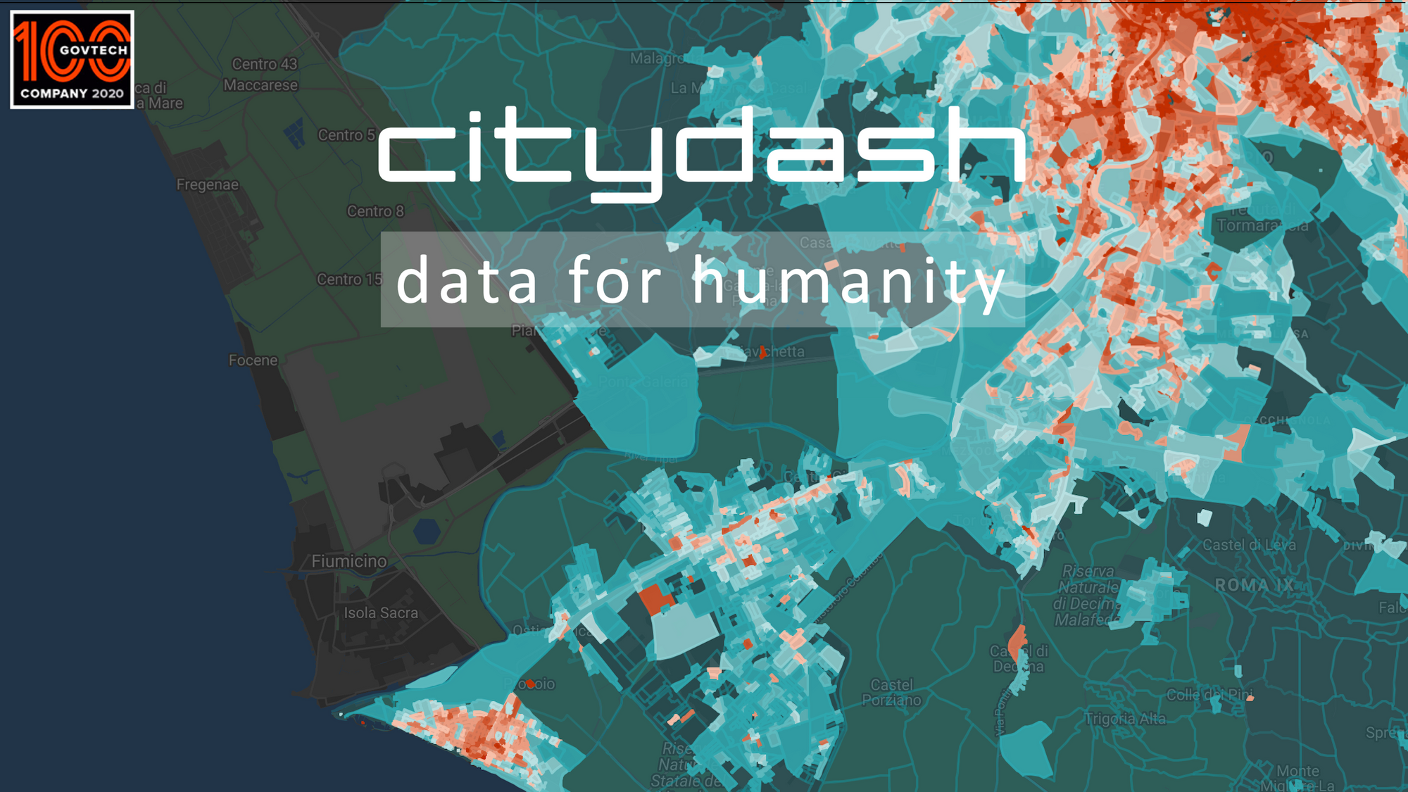
This blog post puts the spotlight on our new initiative called Data for Humanity and our new geospatial dashboard to measure the movement patterns of people across 11 countries.