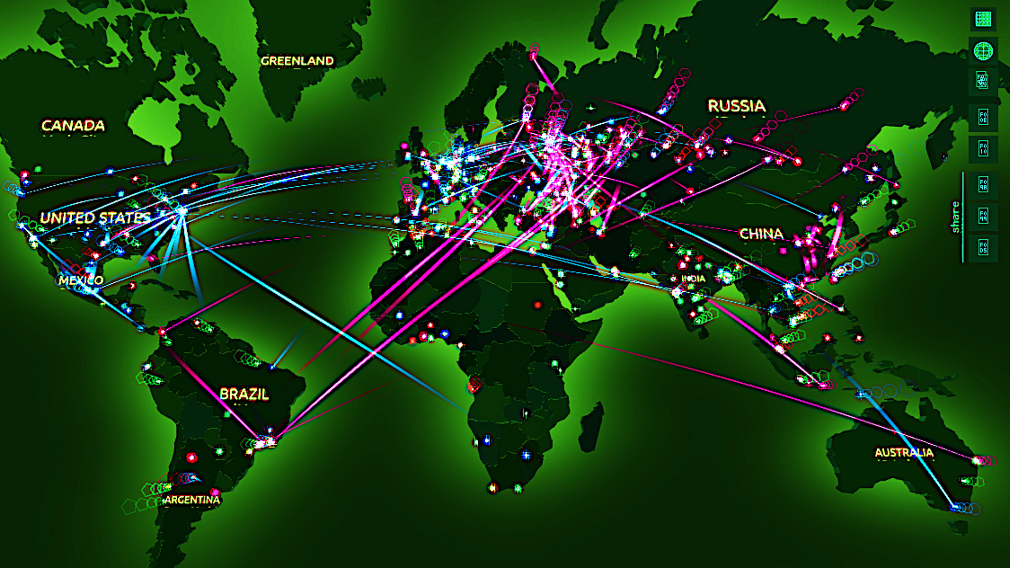
> This blog post discusses the application of crowdsourced GPS-based mobility
datasets which include IP addresses for cybersecurity incident investigations.
> Sign up for our webinars to learn from our data scientists and
> This blog post contains excerpts from the research paper titled "Segregation
Across Neighborhoods in a Small City" by Shu En Lee, Jing Zhi Lim, and Lucas
Shen from the Asia
> This blog post delves into the relevance of GPS-based mobility datasets sourced
from telecommunications carriers and mobile operators for solving real-world
problems.
> Sign up for our webinars to learn from our

UniverCity Council Podcast Series
Guest: (Dr. Cand.) Okkie Putriani, S.T., M.T.
Lecturer - Universitas Atma Jaya Yogyakarta
Ph.D Program - Universitas Gadjah Mada
Hosts: Ruwie Rahardjo and Apurva Kumar
UniverCity.

> This blog post is published in both English and Spanish.
> ESPAÑOL: Esta entrada de blog se adentra en los datos de movilidad y los
patrones de movimiento de disparo salto para
UniverCity Council Podcast Series
Guest: Prof.Chirantan Chatterjee
IIM-Ahmedabad & Stanford University
Hosts: Carl Nielson and Apurva Kumar
UniverCity.ai and CITYDATA.ai
Time Tagged Excerpts:
> 4:20 [https://youtu.be/0C1ubfy8njI?
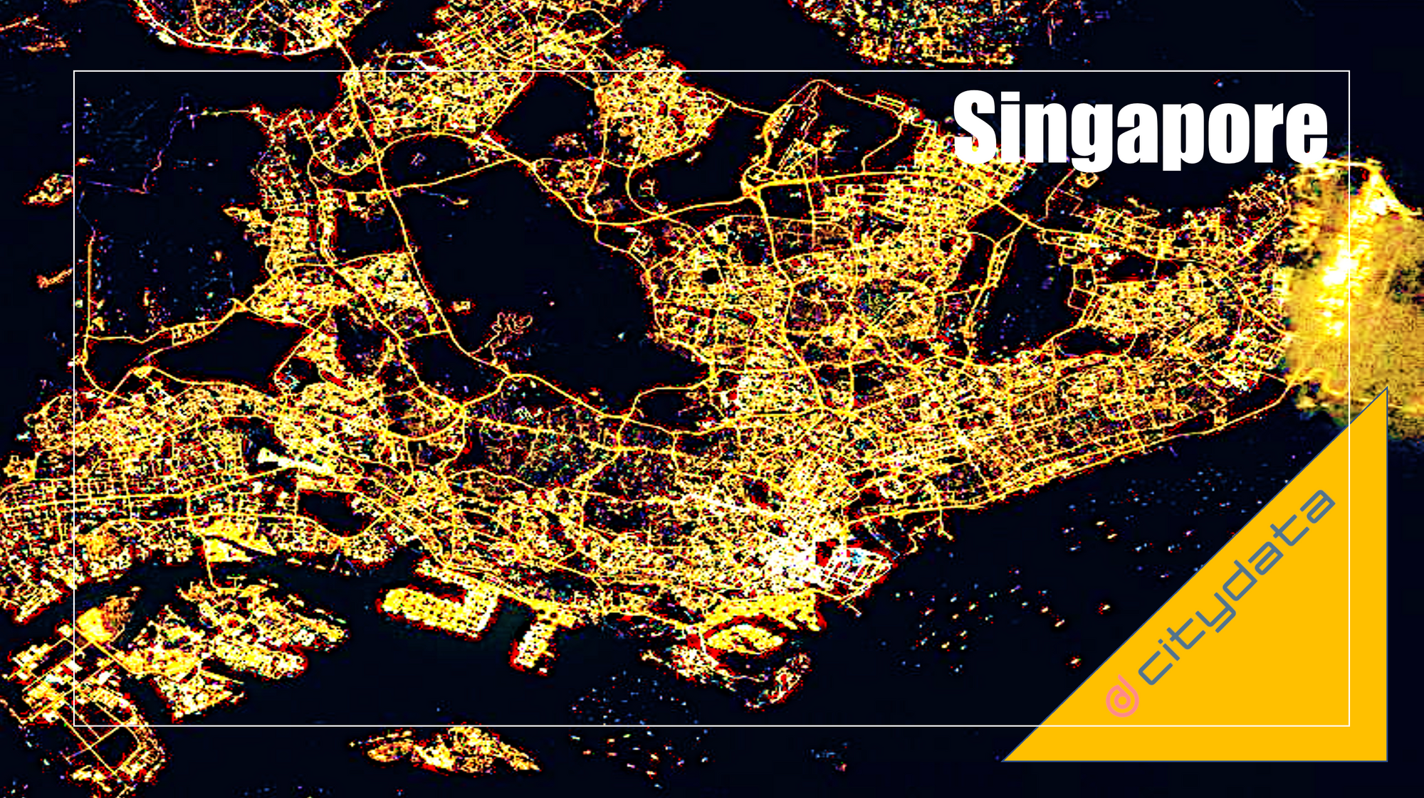
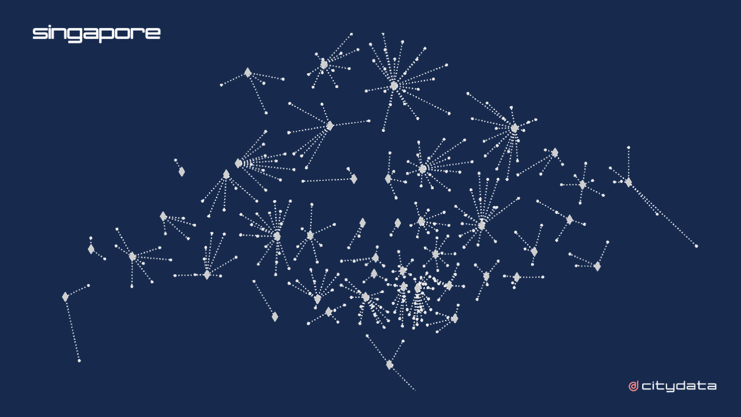
> This blog posts delves into the mobility data and trip hop movement patterns for
Singapore, the financial capital of Asia. The mobility data referenced in this
blog post are published as an

> This blog post and case study, authored by our partner Earthqualizer, discusses
the usage of geospatial data and machine learning for tracking, protecting, and
reversing the impact of palm oil deforestation in

> This blog posts delves into the mobility data and trip hop movement patterns for
the largest metropolitan region in the Americas.
> Sign up for our webinars to learn from our data

> This blog posts delves into the mobility data and trip hop movement patterns for
one of the largest metropolitan regions in the United States.
> Sign up for our webinars to learn

> This blog posts delves into Startup Society's review of three GovTech companies,
their expert opinions and their assessment of the market
> Sign up for our webinars to learn from
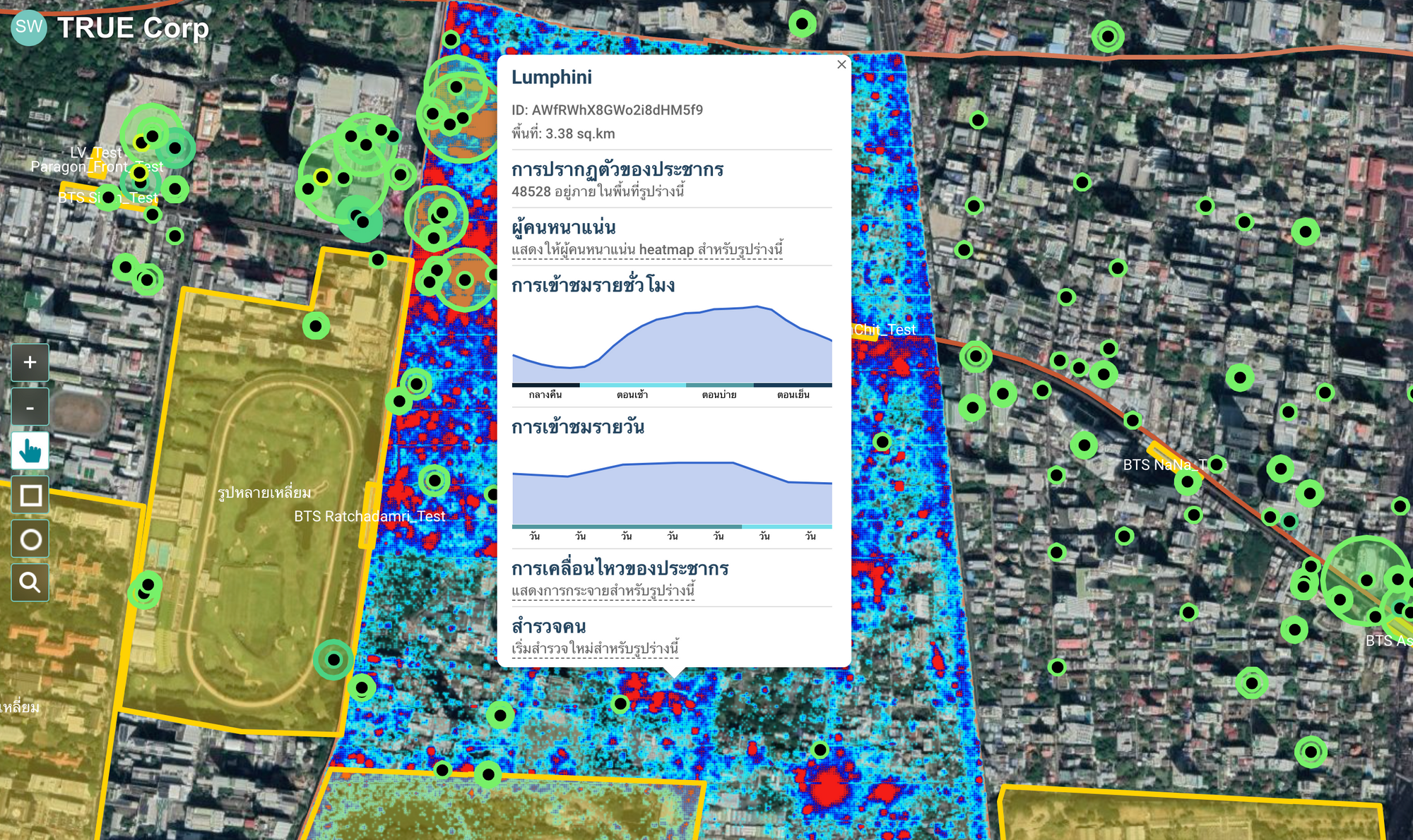
> This blog posts delves into the anonymization and aggregation techniques for
mobility data for govtech, smart city, and civic use cases.
> Sign up for our webinars to learn from our data