Celebrating Our Fifth Consecutive GovTech 100 Win
We are thrilled to announce that we have been named to the GovTech 100 list
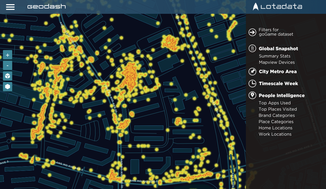
GeoDash.ai provides Mobile Analytics and People Intelligence with fascinating visuals for apps, publishers, demand partners, and telcos.
Team CITYDATA.ai were heads-down developing version 2.0 of GeoDash for the better part of 2018. We are delighted to release the all-new GeoDash today (be sure to watch the preview video below).
Many of you are already familiar with CITYDATA's geo-analytics capabilities. Our platform ingests billions of mobile location data points every day and transforms them into actionable insights about the real-world behaviors of mobile users. We also produce audience segments that can be used for targeted engagement campaigns.
GeoDash 2.0 has all the capabilities of its predecessor, and much more. Mobile app developers can:
App developers can extract data segments and behavioral cohorts using our APIs, from commute patterns to shopping trends and eating habits to fitness preferences. You can personalize your app experience to delight your users at the right moments. And optionally, you can choose to monetize your mobile data through us.
And where does all this location data come from, you ask? From SDKs in mobile apps, of course. We are also thrilled to unveil today version 2.5 of our Android GeoSDK with GDPR-grade data protection, airtight privacy policy, and a mandatory opt-in panel for user consent.
Data collected by our GeoSDK includes the minimum set of attributes listed below. Can your mobile app analytics suite do all this ?
| latitude | Geolocation latitude with level 5 precision |
| longitude | Geolocation longitude with level 5 percision |
| utc_timestamp | Timestamp of recorded location in epoch |
| accuracy | Horizontal accuracy of device location |
| altitude | Altitude in meters above WGS84 reference ellipsoid |
| speed | Speed in meters/second over ground |
| course | Bearing in degrees |
| device_model | Model of the mobile phone |
| device_make | Manufacturer brand of the mobile phone |
| device_os | Operating system and version of the mobile phone |
| carrier | Mobile network carrier or network operator |
| ad_id | The privacy compliant advertising identifier |
| id_type | Type of advertising identifier (idfa, aaid) collected |
| ad_opt_out | Equivalent to the "do not track" flag |
| privacy_opt_in | Explicitly opted into sharing data |
| collect_mode | Foreground and/or background data collection |
| tracking_mode | Manual, Stay Detection, Route Tracking, Hawkeye |
| events | In-app events or tagged user actions |
Did we mention GeoDash is FREE and the GeoSDK is FREE as well? So go ahead and sign up now, before our investors push us to evolve a business model with a pricing plan!
CITYDATA.ai is a San Francisco based startup that has been featured in the GovTech 100 list for 2018, 2019, and 2020, an exclusive list of innovative companies that provide technology products and solutions for the public sector. We provides People Intelligence™ as a service for smarter cities and real-world businesses. By combining public and private data, our technology platform unlocks deep insights that were previously inaccessible to city departments. CITYDATA.ai makes it easy for city leaders to make data-driven decisions to create social impact and engage with local communities. Our AI platform, technology, and service are designed to make cities smarter, safer, and sustainable.